


site search
online catalog
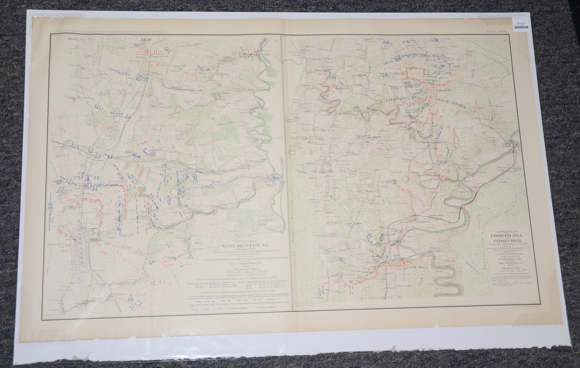
BATTLEFIELD MAPS OF CEDAR CREEK, FISHER’S HILL AND WINCHESTER, VA FROM ATLAS OF OFFICIAL RECORDS
$35.00 SOLD
Quantity Available: None
Item Code: L15152

These pages from an official government atlas feature battlefield maps of Cedar Creek, Fisher’s Hill and Winchester Va. with Union and Confederate positions during the battles in September and October 1864. The Baylor University description reads:
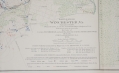
“Battle-fields of Fisher's Hill and Cedar Creek, Virginia. 22 Sept. 1864. 19 Oct. 1864. Prepared by Bvt. Lt. Col. G.L. Gillespie, Major of Engineers, U.S.A., From Surveys made under his direction By Order of Lt. Gen. P.H. Sheridan, and under the Authority of the Hon. Secretary of War and of the Chief of Engineers, U.S.A. 1873 -- Battle-field of Winchester, Va. September 19, 1864. Prepared by Bvt. Lt. Col. G.L. Gillespie, Major of Engineers, U.S.A., from Surveys under his directions. By Order of Lt. Gen. P.H. Sheridan, and under the Authority of the Hon. Secretary of War, and of the Chief of Engineers, U.S.A. 1873 -- Created by Strauch, Siegesmund, Gillespie, Sheridan”
The map is labeled Plate XCIX, from the Atlas to Accompany the Official Records of the Union and Confederate Armies from 1861 to 1865, originally published in 1891. The Atlas to Accompany the Official Records of the Union and Confederate Armies (also referred to as the War of the Rebellion Atlas) was published as a companion piece to the Official Records of the American Civil War. It contains maps and other images derived from materials generated by both Union and Confederate military personnel during the American Civil War.
The pages measure 29.25” long by 18.5” wide. In good condition with some chips missing on the bottom edge.
UPS SHIPPING: East of the Mississippi, $15.00; West of the Mississippi, $20.00. Insurance $5.00 additional.
~~~~~~~~~~~~~~~~~~~~~~~~~~~~~~~~~~~
THIS ITEM, AS WITH ALL OTHER ITEMS AVAILABLE ON OUR WEB SITE,
MAY BE PURCHASED THROUGH OUR LAYAWAY PROGRAM.
FOR OUR POLICIES AND TERMS,
CLICK ON ‘CONTACT US’ AT THE TOP OF ANY PAGE ON THE SITE,
THEN ON ‘LAYAWAY POLICY’.
THANK YOU!
Inquire About BATTLEFIELD MAPS OF CEDAR CREEK, FISHER’S HILL AND WINCHESTER, VA FROM ATLAS OF OFFICIAL RECORDS
For inquiries, please email us at [email protected]
Most Popular
Historical Firearms Stolen From The National Civil War Museum In Harrisburg, Pa »
Theft From Gravesite Of Gen. John Reynolds »
Cavalry Carbine Sling Swivel »
Fine Condition Brass Infantry Bugle Insignia »
featured item
FANTASTIC GETTYSBURG ALS DATED JULY 9, 1863 – HIRAM C. ALLEMAN, MILITARY GOVERNOR OF GETTYSBURG – RESPONSIBLE FOR COLLECTION OF THE DEAD AND WOUNDED, AND DISCARDED MILITARY EQUIPMENT
2pp, in ink, dated Gettysburg, July 9, 1863. Excellent condition, no tears or stains. All clearly legible. Written by Hiram Clay Alleman (1831-1906), newly appointed Military Governor of Gettysburg, to Major John S. Schultz, AAG Dept. of the… (2023-1727). Learn More »