


site search
online catalog
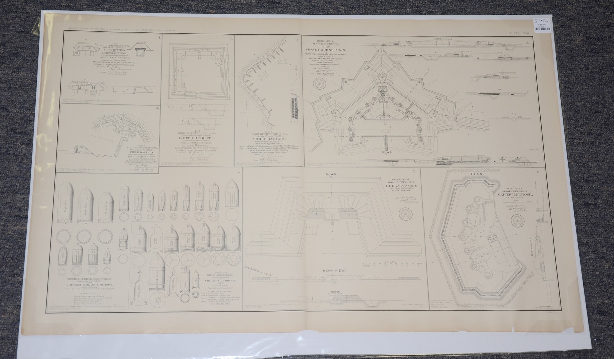
DRAWINGS OF REBEL LINES, MOBILE DEFENSES, FORTS, FIELD BATTERIES AND PROJECTILES FROM ATLAS OF TO ACCOMPANY OFFICIAL RECORDS
$35.00 SOLD
Quantity Available: None
Item Code: L15143


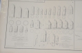
These pages from an official government atlas include seven drawings of rebel lines , mobile defenses, forts and field batteries and two drawings of projectiles used by U.S. forces and rebel forces during the Virginia Campaign of 1864. The description from Baylor University reads:
“Rebel Lines. Mobile Defenses. Battery McIntosh, water battery -- Siege of Petersburg, Va., from July 9th to July 31, 1864. Field Battery. Constructed under the direction of Major J.C. Duane, Chief Engineer, by Capt. G.H. Mendell, U.S. Engrs, assisted by Capt. F. Harwood, U.S. Engrs., Capt. G.L. Gillespie, U.S. Engrs., and Lieut. W.H.H. Benyaurd, U.S. Engrs. Headquarters Army of the Potomac, Engineer Department, October 20, 1864 -- Rebel Lines. Mobile Defenses. Fort Sidney Johnston, N on Lieut. Col. V. Sheliha's line of works. Drawn by order of Maj. McAlester, Chief Engineer Army and Division West Mississippi, under direction of Lieut. S.E. McGregory, Com'dg. Top. Party. H. Holtz, Del. -- Siege of Petersbug, Va., from July 9th to July 31st, 1864. Siege Battery and Mortar Battery Constructed under the direction of Major J.C. Duane, Chief Engineer, by Capt. G.L. Gillespie, U.S. Engrs. Headquarters Army of the Potomac, Engineer Department, October 20, 1864 -- Rebel Lines. Mobile Defenses. Redan Nos. 7 and 8 between redoubts G and F and E. -- Siege of Petersburg, Va., From July 9th to July 31, 1864. Fort Prescott. Constructed under the direction of Major J.C. Duane, Chief Engineer, by Capt. G.L. Gillespie, U.S. Engrs. Headquarters Army of the Potomac, Engineer Department, October 20, 1864 -- Drawings of Rifle Projectiles used by the U.S. Forces in the Virginia Campaign of 1864 / Drawings of Rifle Projectiles used by the Rebels in the Virginia Campaign of 1864 -- Siege of Petersburg, Va., from July 9th to July 31st, 1864. Field Battery Constructed under the direction of Major J.C. Duane, Chief Engineer, by Lieut. H.H. Benyaurd, U.S. Engrs. Headquarters Army of the Potomac Engineer Department, October 20, 1864 -- Created by Michler, Abbot, McAlester, McGregory”.
The map is labeled Plate CVII, from the Atlas to Accompany the Official Records of the Union and Confederate Armies from 1861 to 1865, originally published in 1891. The Atlas to Accompany the Official Records of the Union and Confederate Armies (also referred to as the War of the Rebellion Atlas) was published as a companion piece to the Official Records of the American Civil War. It contains maps and other images derived from materials generated by both Union and Confederate military personnel during the American Civil War.
The map measures 29.25” long by 18.5” wide. In good condition with a few chips on the bottom border.
UPS SHIPPING: East of the Mississippi, $15.00; West of the Mississippi, $20.00. Insurance $5.00 additional.
~~~~~~~~~~~~~~~~~~~~~~~~~~~~~~~~~~~
THIS ITEM, AS WITH ALL OTHER ITEMS AVAILABLE ON OUR WEB SITE,
MAY BE PURCHASED THROUGH OUR LAYAWAY PROGRAM.
FOR OUR POLICIES AND TERMS,
CLICK ON ‘CONTACT US’ AT THE TOP OF ANY PAGE ON THE SITE,
THEN ON ‘LAYAWAY POLICY’.
THANK YOU!
Inquire About DRAWINGS OF REBEL LINES, MOBILE DEFENSES, FORTS, FIELD BATTERIES AND PROJECTILES FROM ATLAS OF TO ACCOMPANY OFFICIAL RECORDS
For inquiries, please email us at [email protected]
Most Popular
Historical Firearms Stolen From The National Civil War Museum In Harrisburg, Pa »
Theft From Gravesite Of Gen. John Reynolds »
Cavalry Carbine Sling Swivel »
Fine Condition Brass Infantry Bugle Insignia »
featured item
VERY SCARCE CIVIL WAR BROGANS
Officially referred to as army bootees, collectors most often know them as brogans, a term used at the time, though soldiers mostly called them just shoes. They were produced in a number of variations, with both sewn and pegged soles, made by hand… (149-42). Learn More »