


site search
online catalog
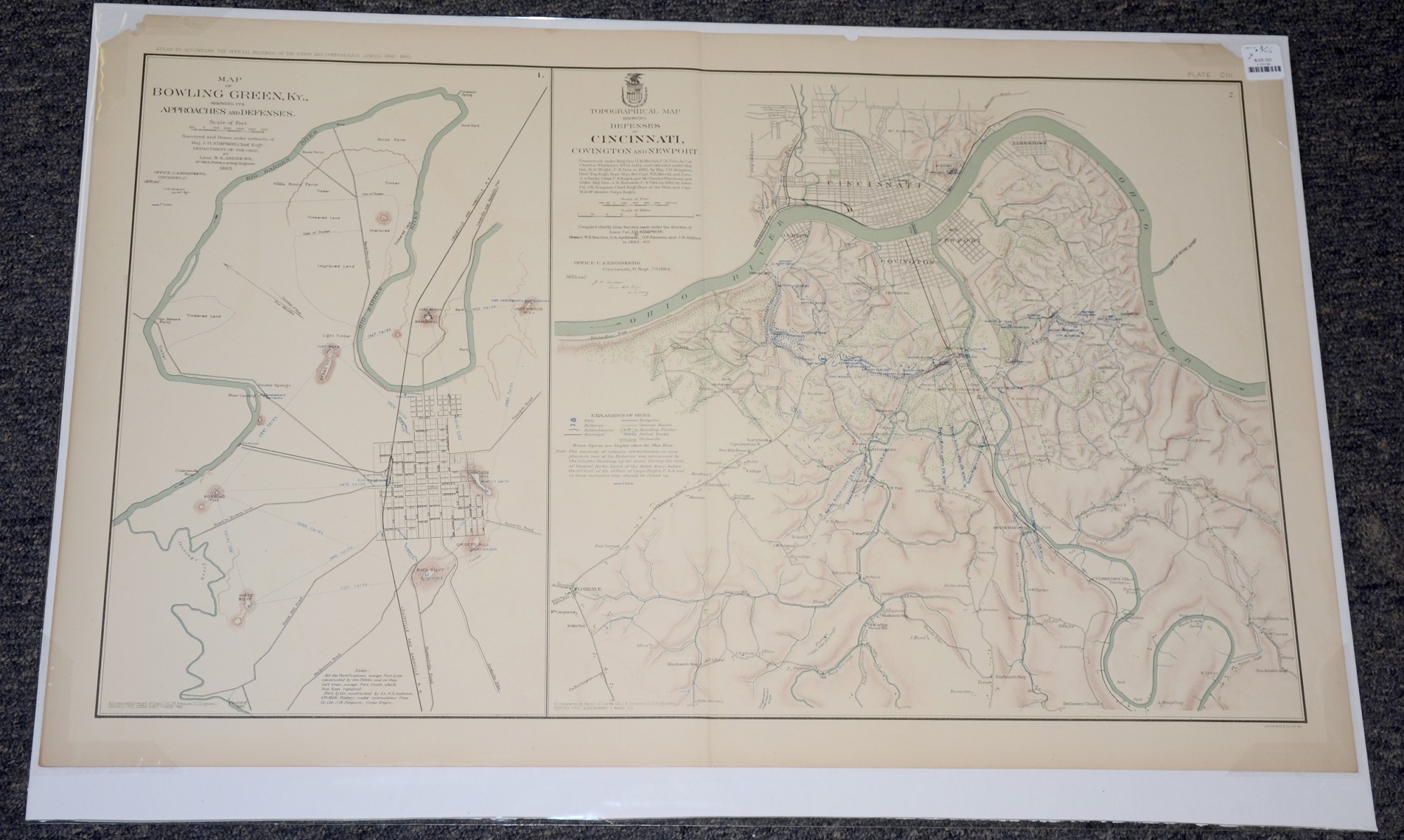
OFFICIAL RECORDS ATLAS MAP OF BOWLING GREEN AND CINCINNATI
$35.00 SOLD
Quantity Available: None
Item Code: L15139
This original print contains maps of Bowling Green, Ky., showing its Approaches and Defenses. 1863 and a topographical map showing Defenses of Cincinnati, Covington and Newport - Created by Simpson, Andrews, Searles, Aschbach, Ransom, Gilliss for the Department of Ohio.
The map is labeled CIII, from the Atlas to Accompany the Official Records of the Union and Confederate Armies from 1861 to 1865, originally published in 1891. The Atlas to Accompany the Official Records of the Union and Confederate Armies (also referred to as the War of the Rebellion Atlas) was published as a companion piece to the Official Records of the American Civil War. It contains maps and other images derived from materials generated by both Union and Confederate military personnel during the American Civil War.
The map measures 29.25” long by 18.5” wide. In good condition with some chips on the top corners and one small chip in the top border.
UPS SHIPPING: East of the Mississippi, $15.00; West of the Mississippi, $20.00. Insurance $5.00 additional.
~~~~~~~~~~~~~~~~~~~~~~~~~~~~~~~~~~~
THIS ITEM, AS WITH ALL OTHER ITEMS AVAILABLE ON OUR WEB SITE,
MAY BE PURCHASED THROUGH OUR LAYAWAY PROGRAM.
FOR OUR POLICIES AND TERMS,
CLICK ON ‘CONTACT US’ AT THE TOP OF ANY PAGE ON THE SITE,
THEN ON ‘LAYAWAY POLICY’.
THANK YOU!
Inquire About OFFICIAL RECORDS ATLAS MAP OF BOWLING GREEN AND CINCINNATI
For inquiries, please email us at [email protected]
Most Popular
Historical Firearms Stolen From The National Civil War Museum In Harrisburg, Pa »
Theft From Gravesite Of Gen. John Reynolds »
Cavalry Carbine Sling Swivel »
Fine Condition Brass Infantry Bugle Insignia »
featured item
QUARTER-PLATE AMBROTYPE AND TWO LETTERS OF CONFEDERATE OFFICER RUNNELS DAVIS, WHO DIED OF WOUNDS RECEIVED AT THIRD WINCHESTER
Runnels Davis was born June 1, 1835. He was the first-born son of Alfred Ward Grayson Davis who was a roommate and third cousin, once removed, of future Confederate President Jefferson Davis at West Point. Alfred Davis left West Point before… (846-521). Learn More »