


site search
online catalog
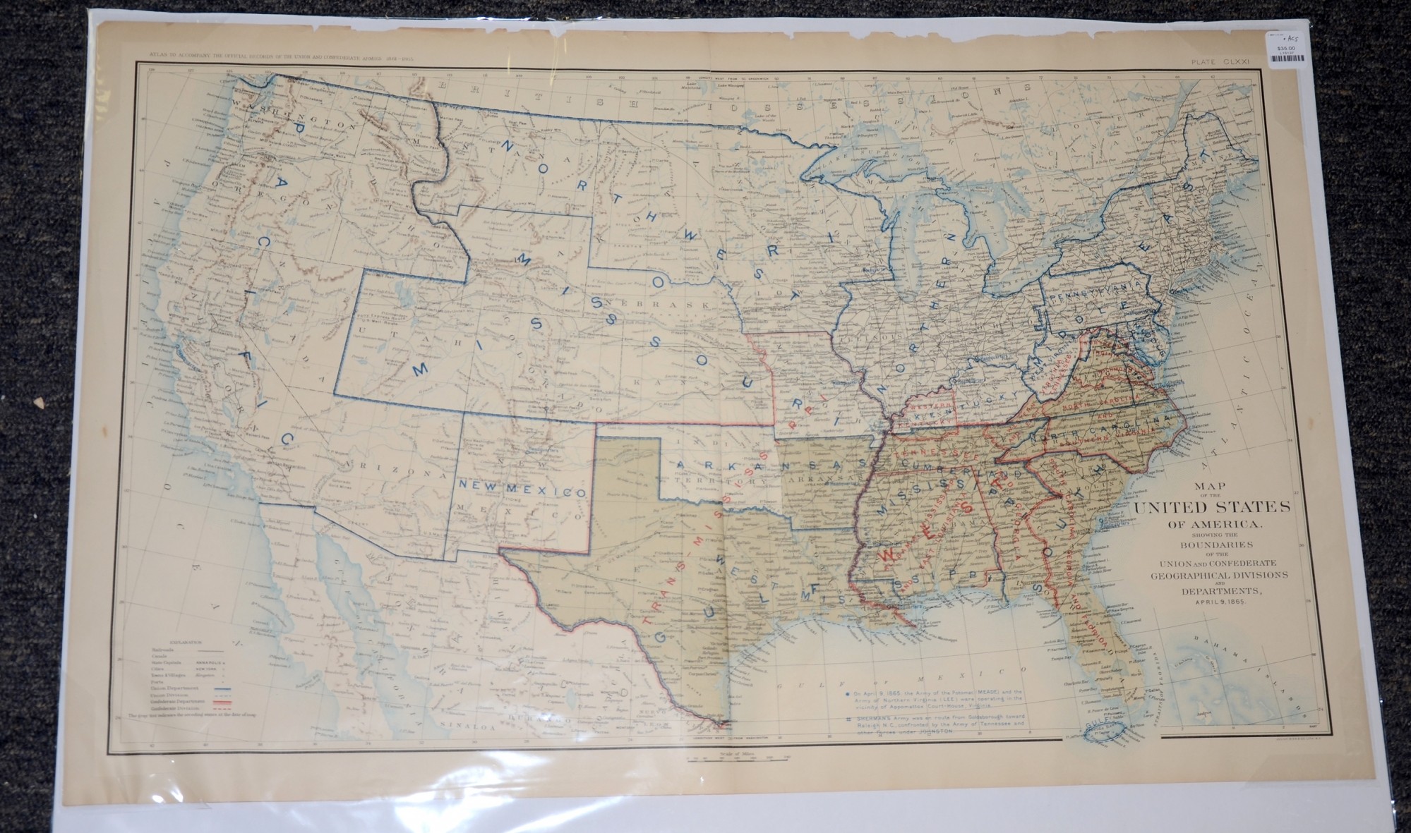
APRIL 9, 1865 ATLAS MAP OF THE UNITED STATES WITH UNION AND CONFEDERATE BOUNDARIES
$35.00 SOLD
Quantity Available: None
Item Code: L15137
This is a map of the United States of America, showing the Boundaries of the Union and Confederate Geographical Divisions and Departments, April 9, 1865.
The map is labeled Plate CLXXI, from the Atlas to Accompany the Official Records of the Union and Confederate Armies from 1861 to 1865, originally published in 1891.
The map measures 29.25” long by 18.5” wide. In good condition with some significant chipping on the top border, two inch tears on the fold and two small symmetrical tears at the bottom.
UPS SHIPPING: East of the Mississippi, $15.00; West of the Mississippi, $20.00. Insurance $5.00 additional.
~~~~~~~~~~~~~~~~~~~~~~~~~~~~~~~~~~~
THIS ITEM, AS WITH ALL OTHER ITEMS AVAILABLE ON OUR WEB SITE,
MAY BE PURCHASED THROUGH OUR LAYAWAY PROGRAM.
FOR OUR POLICIES AND TERMS,
CLICK ON ‘CONTACT US’ AT THE TOP OF ANY PAGE ON THE SITE,
THEN ON ‘LAYAWAY POLICY’.
THANK YOU!
Inquire About APRIL 9, 1865 ATLAS MAP OF THE UNITED STATES WITH UNION AND CONFEDERATE BOUNDARIES
For inquiries, please email us at [email protected]
Most Popular
Historical Firearms Stolen From The National Civil War Museum In Harrisburg, Pa »
Theft From Gravesite Of Gen. John Reynolds »
Cavalry Carbine Sling Swivel »
Fine Condition Brass Infantry Bugle Insignia »
featured item
1862 TIFFANY GENERAL GUIDE FLAG OF THE 143rd NEW YORK
This Tiffany-made general guide flag was certainly among the colors presented to the 143rd New York Volunteers upon its formal organization in October 1862. Like the embroidered stars-and-stripes national color presented on that occasion, and now in… (1179-017). Learn More »