


site search
online catalog
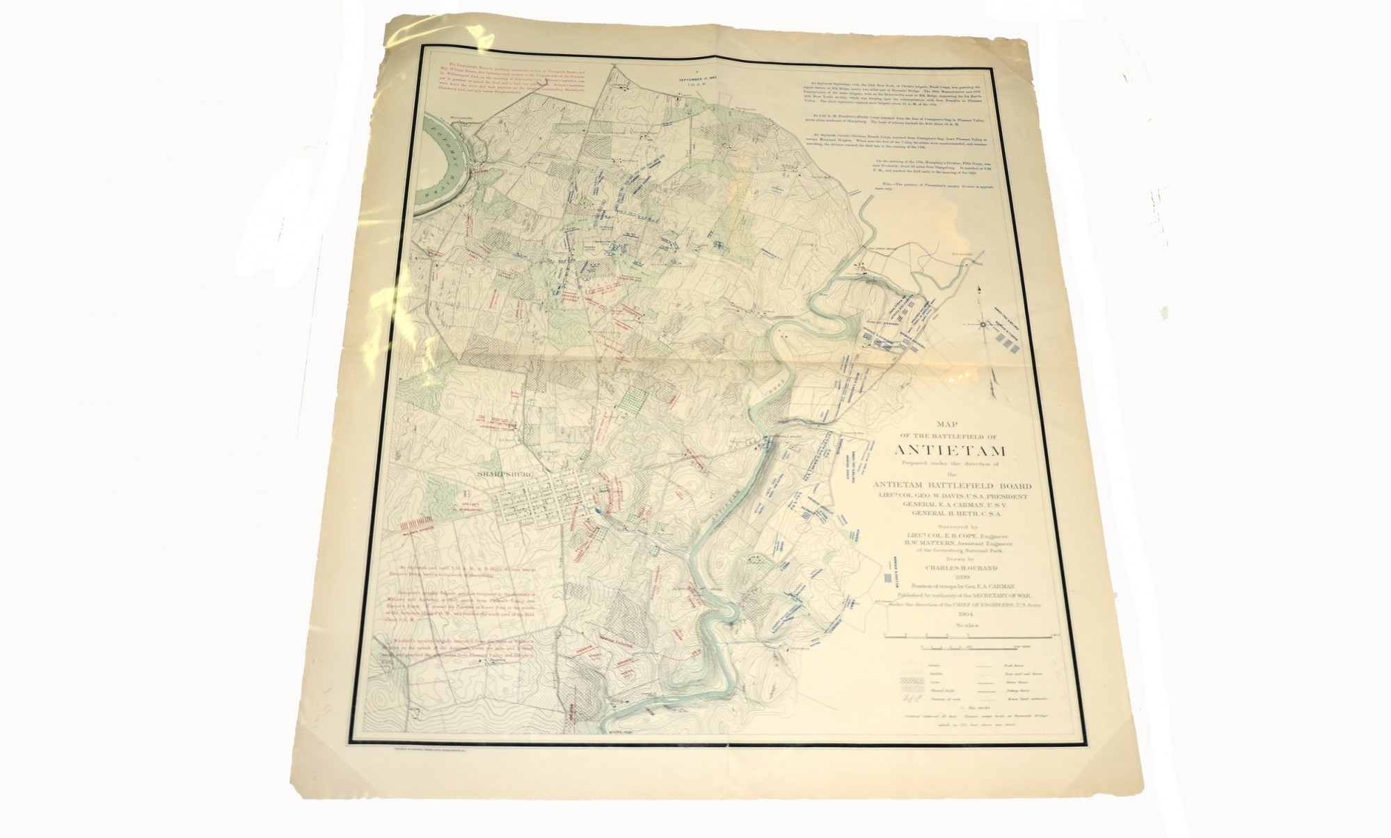
MAP OF THE BATTLEFELD OF ANTIETAM
$100.00 SOLD
Quantity Available: None
Item Code: L14538

Drawn by Charles Ourand. Published by the direction of the Secretary of the War, under the directions of the Chief of Engineers, U.S. Army. Andrew B. Graham, Photo-Litho, DC., 1904. 28 x 34.25”, color projection of Federal and Confederate positions, 7:30 AM, 17 September ,1862. Exhibits light chipping at corners, else VG. In protective sleeve.
EXTRA SHIPPING REQUIRED
~~~~~~~~~~~~~~~~~~~~~~~~~~~~~~~~~~~
THIS ITEM, AS WITH ALL OTHER ITEMS AVAILABLE ON OUR WEB SITE,
MAY BE PURCHASED THROUGH OUR LAYAWAY PROGRAM.
FOR OUR POLICIES AND TERMS,
CLICK ON ‘CONTACT US’ AT THE TOP OF ANY PAGE ON THE SITE,
THEN ON ‘LAYAWAY POLICY’.
Inquire About MAP OF THE BATTLEFELD OF ANTIETAM
For inquiries, please email us at [email protected]
Most Popular
Historical Firearms Stolen From The National Civil War Museum In Harrisburg, Pa »
Theft From Gravesite Of Gen. John Reynolds »
Cavalry Carbine Sling Swivel »
Fine Condition Brass Infantry Bugle Insignia »
featured item
CIVIL WAR COMMODORE’S UNDRESS FROCK COAT OF SILAS H. STRINGHAM, USN: LEADER OF THE FIRST COMBINED OPERATION OF THE UNION NAVY AND ARMY IN THE CIVIL WAR; VICTOR OF THE BATTLE OF HATTERAS INLET BATTERIES
Fought on Aug. 28-29, 1861, little more than a month after the Union defeat at Bull Run, the capture of Forts Hatteras and Clark on the outer banks helped restrict Confederate blockade running, enabled further operations on the North Carolina coast,… (1179-504). Learn More »