


site search
online catalog
HISTORICAL WAR MAP, 1863
$150.00 SOLD
Quantity Available: None
Item Code: 388-40

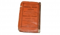
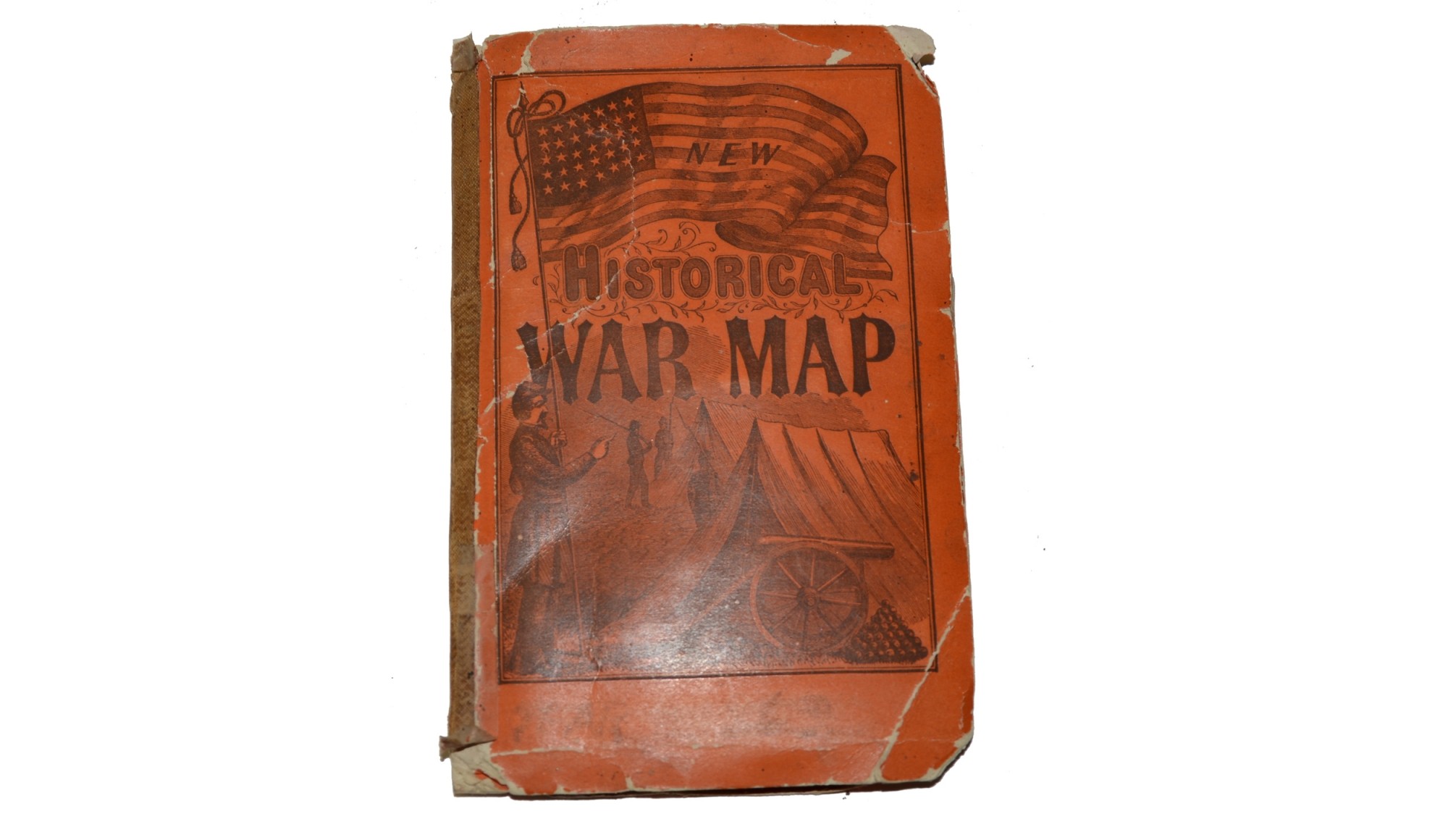
This fold-out colorful map was printed in 1863 by Phelps & Watson, New York. The orange softcover has a war time image of a Union soldier holding a US flag, with a cannon, tents and other soldiers in the background.
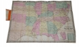
Title at top of map reads, “PHELPS & WATSON’S HISTORICAL AND MILITARY MAP OF THE BORDER AND SOUTHERN STATES”. Bottom right corner of map is marked with, “PHELPS & WATSON’S HISTORICAL AND MILITARY MAP OF THE BORDER & SOUTHERN STATES, PUBLISHED BY PHELPS & WATSON, 18 BEEKMAN ST. NEW YORK 1863”. Below this, in a highlighted box, is a list of Civil War battles in alphabetical order.
This important Civil War map focuses on the Confederate states including Texas, and the bordering states from Nebraska to Pennsylvania. Good detail throughout including towns, railroads, forts, and distances from place to place along the railroads. It presents the war's battles marked throughout with red colored dots. Blue dots mark the population statistics for each state and in the southern states free and slave populations are noted. At lower right is an extensive list of "Battles of the War." Battles are listed up through November 1862. The map extends north into Lake Erie and west to include most of Texas, Indian Territory, Kansas, and Nebraska. In Florida the map ends in the vicinity of Bayport and Mellon with an inset on the same scale completing the state to Key West and Dry Tortugas. Copyright 1863, the map was regularly updated during and after the war, this being a Civil War Edition. The railroads are well delineated but are not named. Surrounded by decorative border with corner graphic elements.
Map is in very good condition, overall, with a few very tiny tears along fold lines. Paper has slightly yellowed with age. Orange cover has chipped corners and has been taped at the spine.
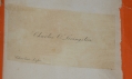
Inside of cover has a calling card pasted from a previous owner which reads, “CHARLES O. LIVINGSTON”.
When folded inside of cover, measures 7” x 4 ½”. While unfolded, map measures 25 ½” x 35 ½”.
~~~~~~~~~~~~~~~~~~~~~~~~~~~~~~~~~~~
THIS ITEM, AS WITH ALL OTHER ITEMS AVAILABLE ON OUR WEB SITE,
MAY BE PURCHASED THROUGH OUR LAYAWAY PROGRAM.
FOR OUR POLICIES AND TERMS,
CLICK ON ‘CONTACT US’ AT THE TOP OF ANY PAGE ON THE SITE,
THEN ON ‘LAYAWAY POLICY’.
THANK YOU!
Inquire About HISTORICAL WAR MAP, 1863
For inquiries, please email us at [email protected]
Most Popular
Historical Firearms Stolen From The National Civil War Museum In Harrisburg, Pa »
Theft From Gravesite Of Gen. John Reynolds »
Cavalry Carbine Sling Swivel »
Fine Condition Brass Infantry Bugle Insignia »
featured item
MODEL 1841 NAVAL OFFICER’S SWORD IDENTIFIED TO SIMON BACKUS BISSELL
Simon Backus Bissell was born in Fairlee, Vt., on October 28, 1808. He was appointed Midshipman on November 6, 1824, Passed Midshipman on June 4 1831, and Lieutenant December 9, 1837. At the beginning of the Mexican-American War, he was assigned to… (870-63). Learn More »