


site search
online catalog
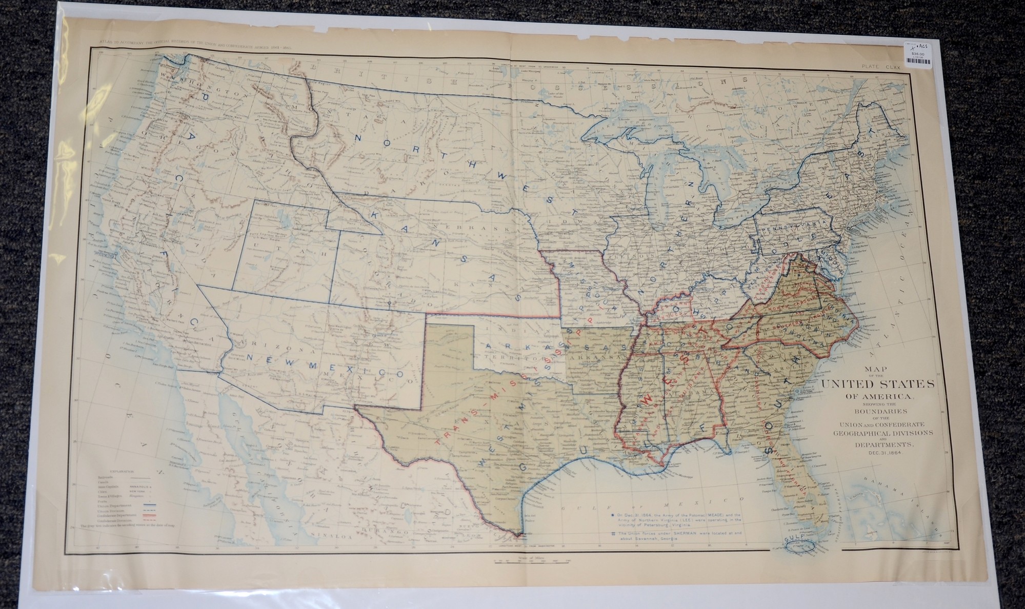
DECEMBER 1864 ATLAS MAP OF USA – UNION AND CONFEDERATE DIVISIONS IN COLOR
$35.00 SOLD
Quantity Available: None
Item Code: L15135
This is a map of the United States of America, showing the Boundaries of the Union and Confederate Geographical Divisions and Departments, Dec. 31, 1864. It is labeled Plate CLXX, from the Atlas to Accompany the Official Records of the Union and Confederate Armies from 1861 to 1865, originally published in 1891.
The map measures 29.25” long by 18.5” wide. In good condition with two small symmetrical tears at the bottom, some chipping at the top and a slight crease at the top near the fold.
UPS SHIPPING: East of the Mississippi, $15.00; West of the Mississippi, $20.00. Insurance $5.00 additional.
~~~~~~~~~~~~~~~~~~~~~~~~~~~~~~~~~~~
THIS ITEM, AS WITH ALL OTHER ITEMS AVAILABLE ON OUR WEB SITE,
MAY BE PURCHASED THROUGH OUR LAYAWAY PROGRAM.
FOR OUR POLICIES AND TERMS,
CLICK ON ‘CONTACT US’ AT THE TOP OF ANY PAGE ON THE SITE,
THEN ON ‘LAYAWAY POLICY’.
THANK YOU!
Inquire About DECEMBER 1864 ATLAS MAP OF USA – UNION AND CONFEDERATE DIVISIONS IN COLOR
For inquiries, please email us at [email protected]
Most Popular
Historical Firearms Stolen From The National Civil War Museum In Harrisburg, Pa »
Theft From Gravesite Of Gen. John Reynolds »
Cavalry Carbine Sling Swivel »
Fine Condition Brass Infantry Bugle Insignia »
featured item
FANTASTIC GETTYSBURG ALS DATED JULY 9, 1863 – HIRAM C. ALLEMAN, MILITARY GOVERNOR OF GETTYSBURG – RESPONSIBLE FOR COLLECTION OF THE DEAD AND WOUNDED, AND DISCARDED MILITARY EQUIPMENT
2pp, in ink, dated Gettysburg, July 9, 1863. Excellent condition, no tears or stains. All clearly legible. Written by Hiram Clay Alleman (1831-1906), newly appointed Military Governor of Gettysburg, to Major John S. Schultz, AAG Dept. of the… (2023-1727). Learn More »