


site search
online catalog
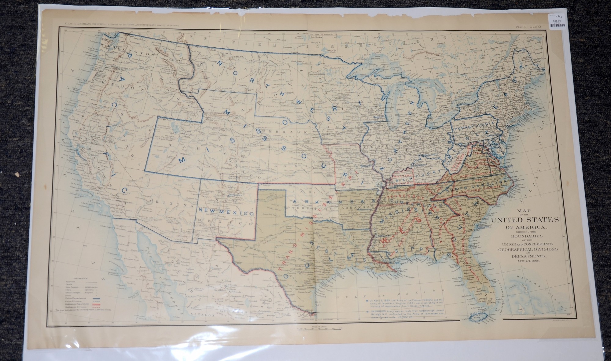
APRIL 9, 1865 ATLAS MAP OF THE UNITED STATES WITH UNION AND CONFEDERATE BOUNDARIES
Hover to zoom
$35.00 SOLD
Quantity Available: None
Item Code: L15137
This is a map of the United States of America, showing the Boundaries of the Union and Confederate Geographical Divisions and Departments, April 9, 1865.
The map is labeled Plate CLXXI, from the Atlas to Accompany the Official Records of the Union and Confederate Armies from 1861 to 1865, originally published in 1891.
The map measures 29.25” long by 18.5” wide. In good condition with some significant chipping on the top border, two inch tears on the fold and two small symmetrical tears at the bottom.
UPS SHIPPING: East of the Mississippi, $15.00; West of the Mississippi, $20.00. Insurance $5.00 additional.
~~~~~~~~~~~~~~~~~~~~~~~~~~~~~~~~~~~
THIS ITEM, AS WITH ALL OTHER ITEMS AVAILABLE ON OUR WEB SITE,
MAY BE PURCHASED THROUGH OUR LAYAWAY PROGRAM.
FOR OUR POLICIES AND TERMS,
CLICK ON ‘CONTACT US’ AT THE TOP OF ANY PAGE ON THE SITE,
THEN ON ‘LAYAWAY POLICY’.
THANK YOU!
Inquire About APRIL 9, 1865 ATLAS MAP OF THE UNITED STATES WITH UNION AND CONFEDERATE BOUNDARIES
Most Popular
Historical Firearms Stolen From The National Civil War Museum In Harrisburg, Pa »
Theft From Gravesite Of Gen. John Reynolds »
Selection Of Unframed Prints By Don Troiani »
Fine Condition Brass Infantry Bugle Insignia »
featured item
EYE-CATCHING 1859-1861 VIRGINIA MILITIA GROUPING OF CAPT. J.Q.A. NADENBOUSCH, BERKELEY BORDER GUARDS, LATER COLONEL 2nd VA INFANTRY OM RECOMMENDATION OF LEE AND STONEWALL JACKSON
An historic and eye-catching Virginia officer’s group belonging to John Quincy Adams Nadenbousch while Captain of the “Berkeley Border Guards,” a militia company raised in response to the John Brown raid, present at the execution of Brown’s… (2025-3677). Learn More »