


site search
online catalog
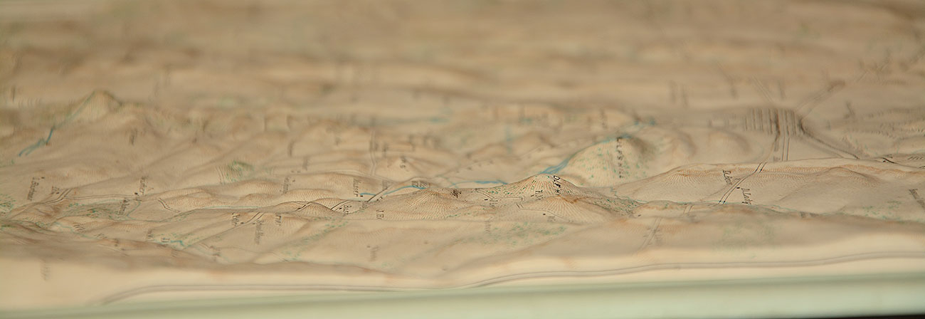
C1950’S TOPOGRAPHICAL RELIEF MAP OF GETTYSBURG
Hover to zoom
$195.00 SOLD
Quantity Available: None
Item Code: 635-512
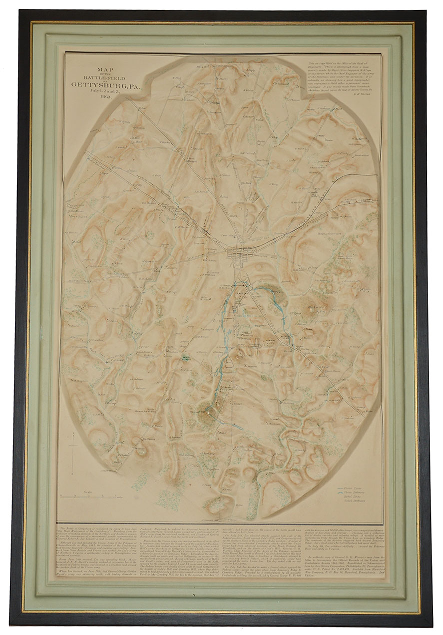
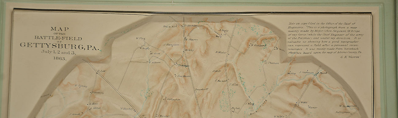
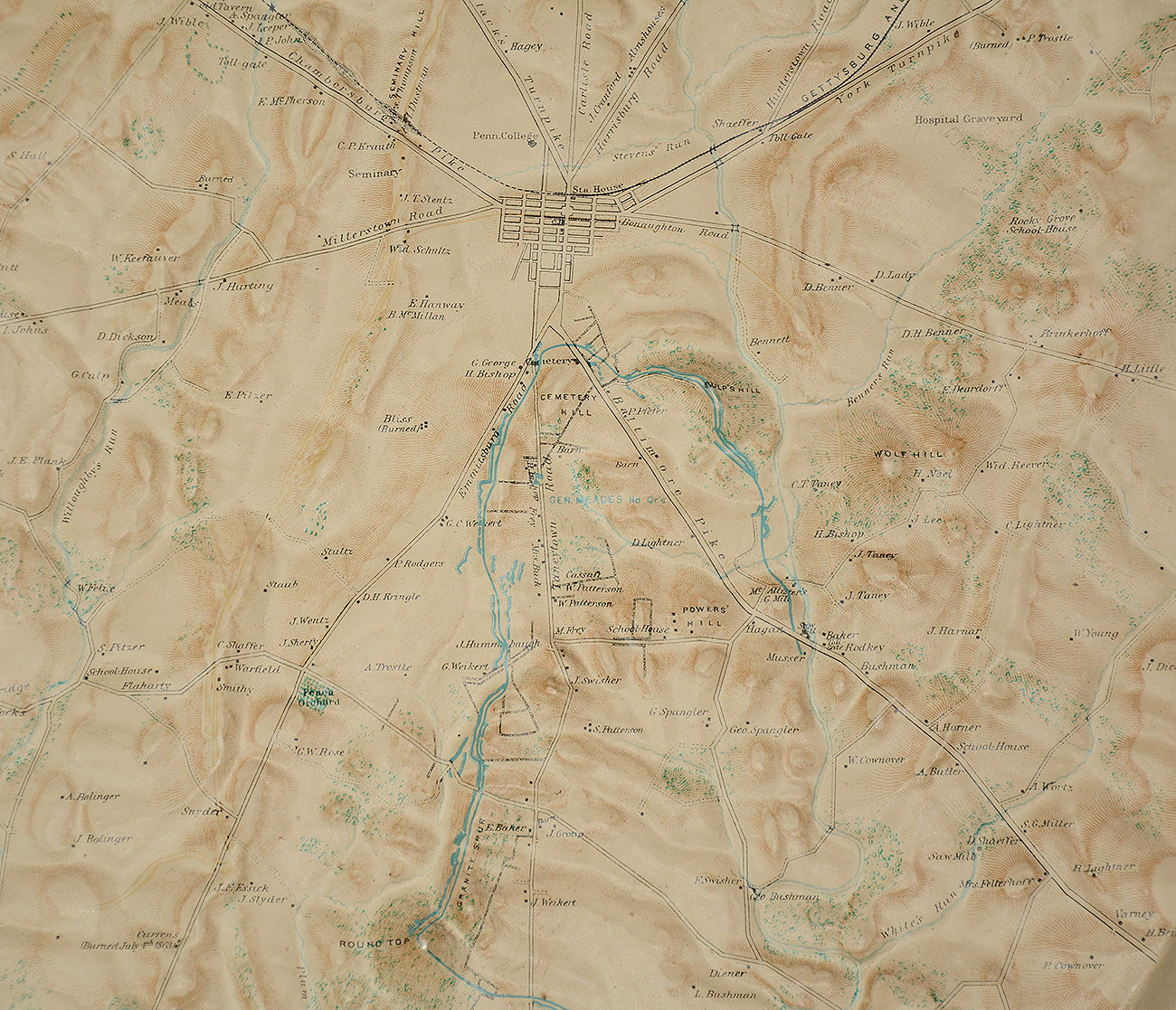
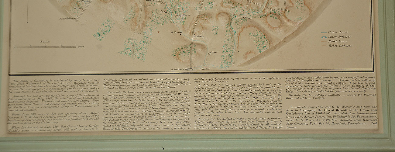
This is a circa 1950s relief map of Gettysburg produced from a copy of General G.K. Warren's map from the Atlas to Accompany the Official Records of the Union and Confederate Armies 1861-1865. This is a very interesting map of the Gettysburg area made of plastic and moulded in relief to show the terrain. Union and Confederate positions are shown in blue and red. All features illustrated including homes, wooded areas, hills, mountains, and roads.
It was republished in 3-dimensional form by Aero Service Corporation, Philadelphia 20, Pennsylvania and sold by the Haverford Map Company. It is a second edition map; it is housed in a modern frame which. measures 14 ¼” X 21 ¼”. Overall very fine; the only damage is to the frame’s paper backing. [ld] [ph:L]
~~~~~~~~~~~~~~~~~~~~~~~~~~~~~~~~~~~
THIS ITEM, AS WITH ALL OTHER ITEMS AVAILABLE ON OUR WEB SITE,
MAY BE PURCHASED THROUGH OUR LAYAWAY PROGRAM.
FOR OUR POLICIES AND TERMS,
CLICK ON ‘CONTACT US’ AT THE TOP OF ANY PAGE ON THE SITE,
THEN ON ‘LAYAWAY POLICY’.
Inquire About C1950’S TOPOGRAPHICAL RELIEF MAP OF GETTYSBURG
Most Popular
Historical Firearms Stolen From The National Civil War Museum In Harrisburg, Pa »
Theft From Gravesite Of Gen. John Reynolds »
Selection Of Unframed Prints By Don Troiani »
Fine Condition Brass Infantry Bugle Insignia »
featured item
VERY FINE, VERY RARE .36 CALIBER, 6-CAVITY GANG MOLD FOR COLT M1851 NAVY REVOLVER
Measuring 13” long, this iron bullet mold casts six .36 caliber elongated pistol bullets. Turned wood handles and brass ferrules are fitted over the arms of the mold halves. The sprue cutter is attached to the top at the hinge pin and swings from… (1304-117). Learn More »