


site search
online catalog
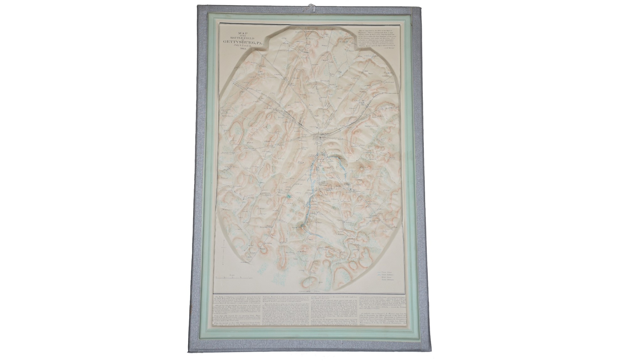
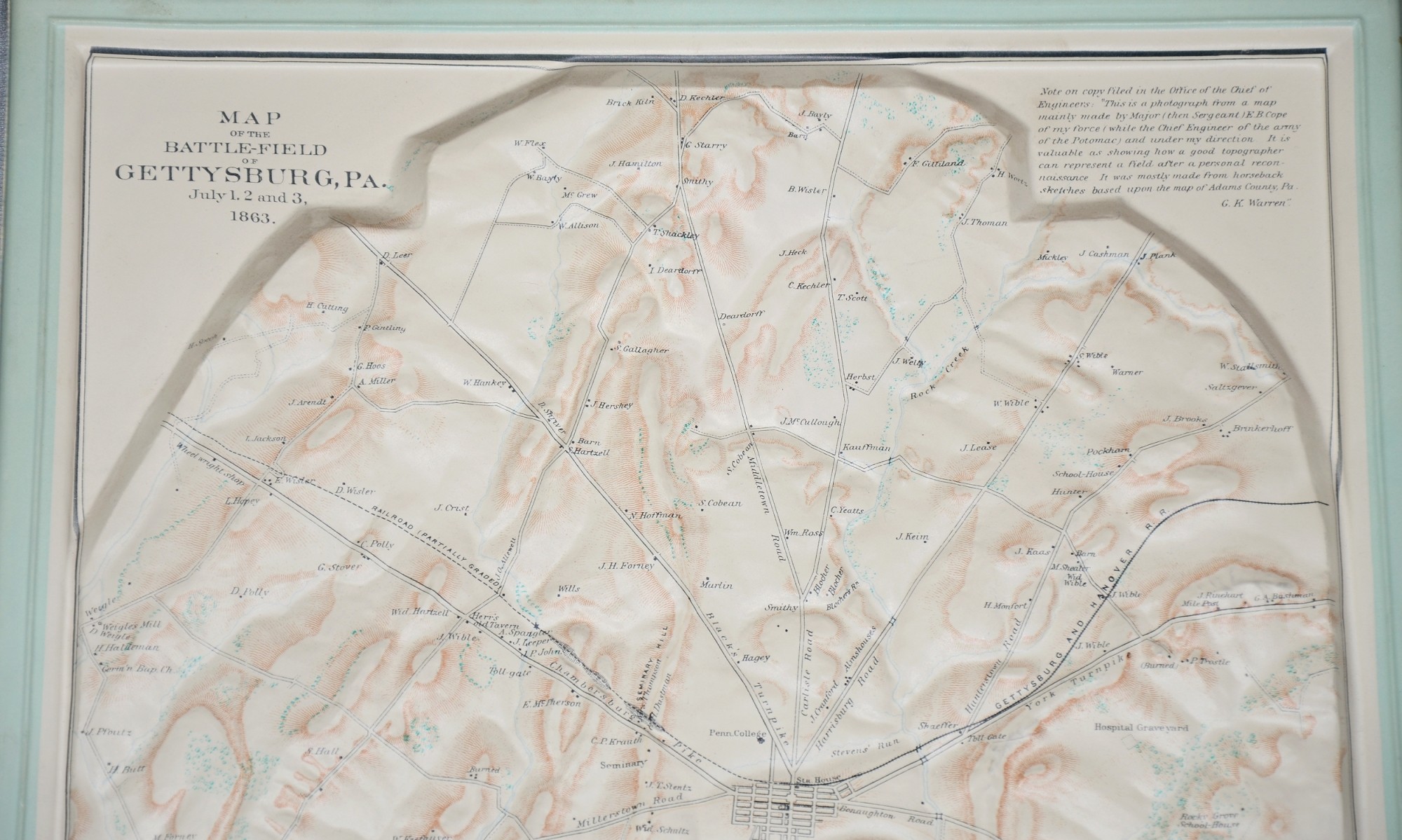
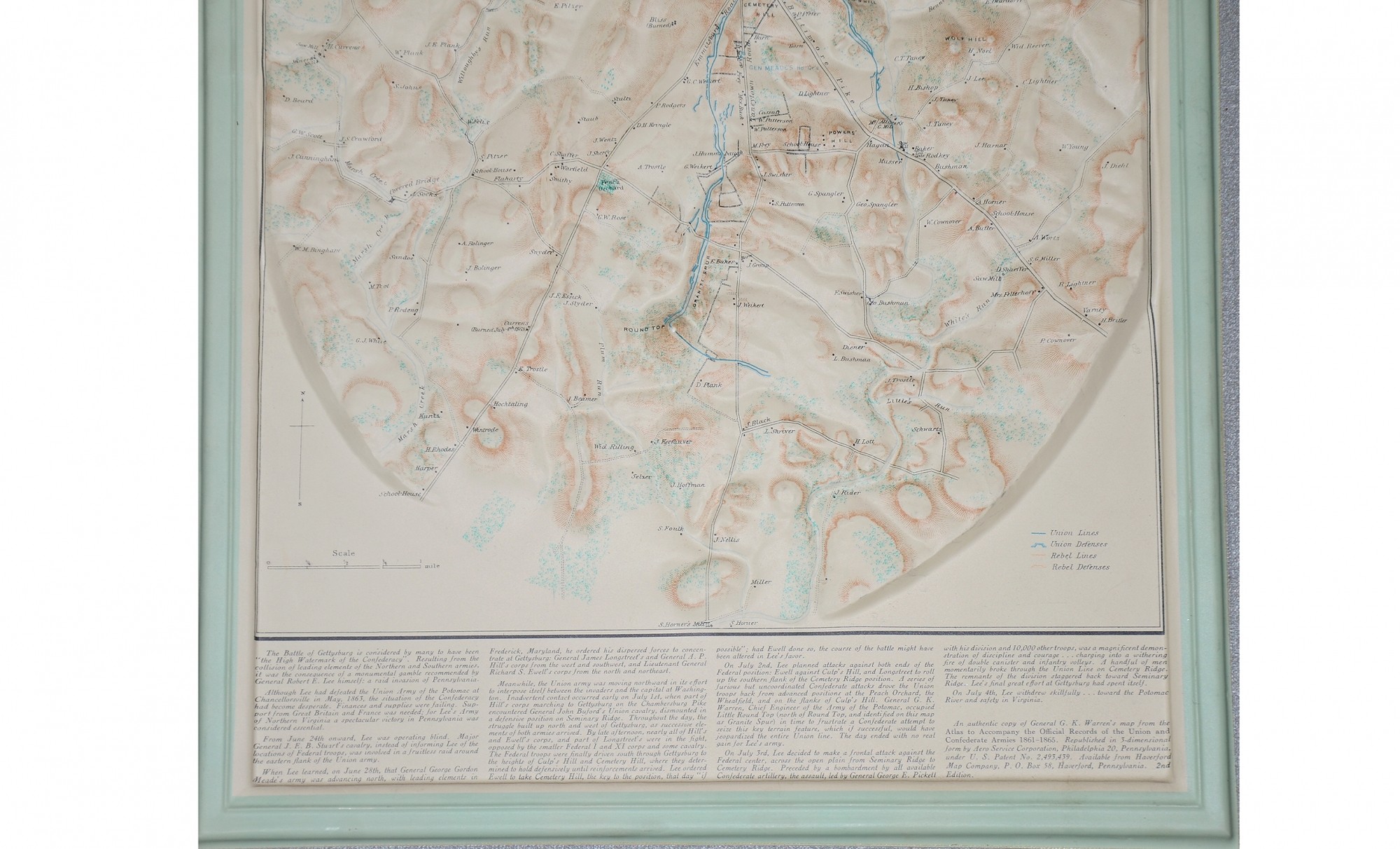
CIRCA 1950s RELIEF MAP OF GETTYSBURG
Hover to zoom
$195.00 SOLD
Quantity Available: None
Item Code: 601-134
This is a circa 1950s relief map of Gettysburg produced from a copy of General G.K. Warren's map from the Atlas to Accompany the Official Records of the Union and Confederate Armies 1861-1865. It was republished in 3-dimensional form by Aero Service Corporation, Philadelphia 20, Pennsylvania and sold by the Haverford Map Company. It is a second edition map that measures 20.75" tall and 13.74" wide.
~~~~~~~~~~~~~~~~~~~~~~~~~~~~~~~~~~~
THIS ITEM, AS WITH ALL OTHER ITEMS AVAILABLE ON OUR WEB SITE,
MAY BE PURCHASED THROUGH OUR LAYAWAY PROGRAM.
FOR OUR POLICIES AND TERMS,
CLICK ON ‘CONTACT US’ AT THE TOP OF ANY PAGE ON THE SITE,
THEN ON ‘LAYAWAY POLICY’.
THANK YOU!
Inquire About CIRCA 1950s RELIEF MAP OF GETTYSBURG
Most Popular
Historical Firearms Stolen From The National Civil War Museum In Harrisburg, Pa »
Theft From Gravesite Of Gen. John Reynolds »
Selection Of Unframed Prints By Don Troiani »
Fine Condition Brass Infantry Bugle Insignia »
featured item
CONFEDERATE SURGEON'S KEPI FOUND IN SOUTH CAROLINA
This cap was discovered in a Civil War period home in Charleston SC near "The Battery" neighborhood not many years ago. When found the cap needed a few minor repairs but it otherwise remains untouched as found and in marvelous condition! The body of… (1130-09). Learn More »
site search
Upcoming Events
The shop is currently closed so that we may conduct our annual inventory. We are available by phone… Learn More »