


site search
online catalog
BOOK & MAPS – VIRGINIA CIVIL WAR BATTLES AND LEADERS SERIES – “SECOND MANASSAS BATTLEFIELD MAP STUDY”
Hover to zoom
$125.00 SOLD
Quantity Available: None
Item Code: 1180-268
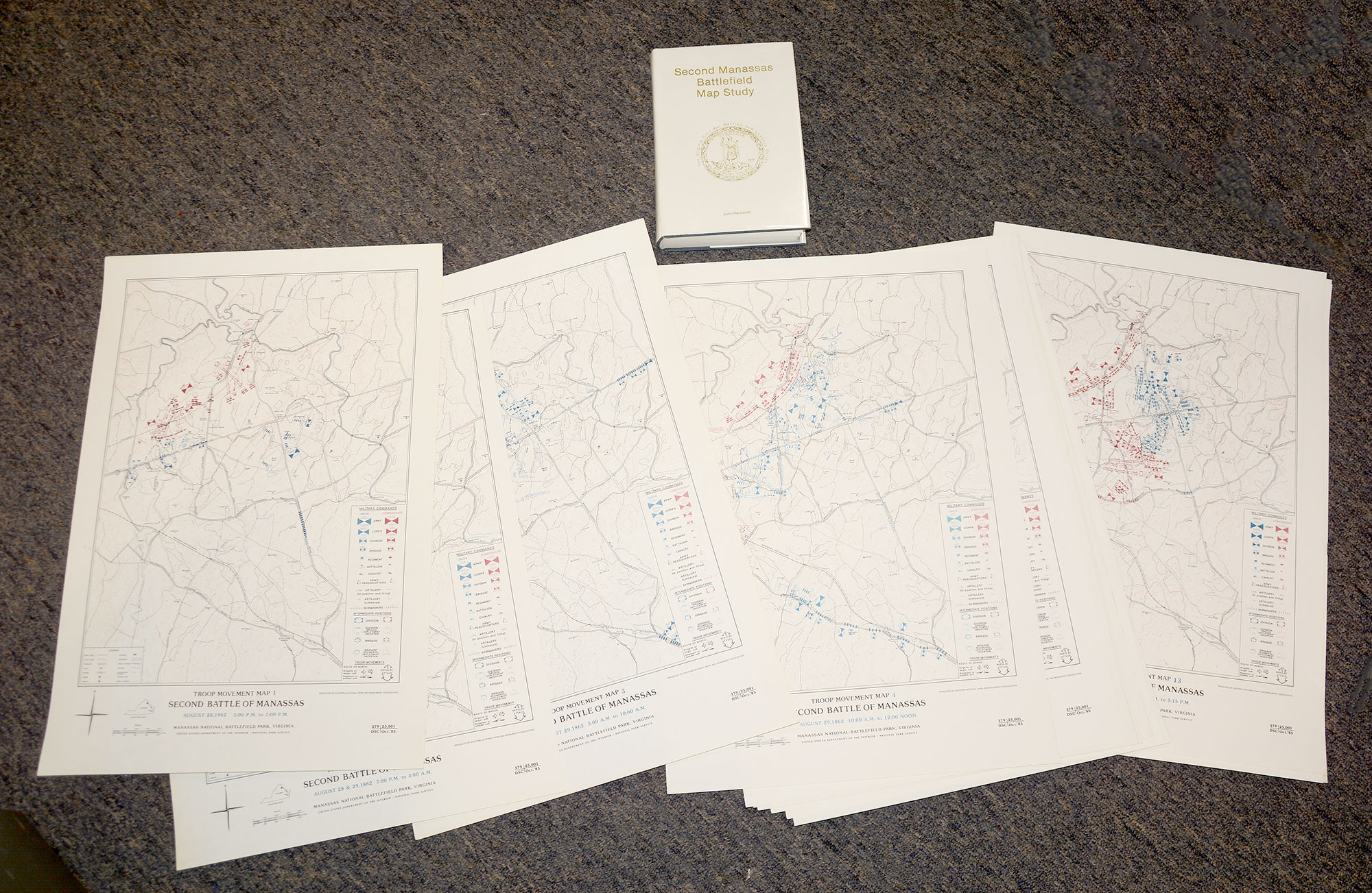
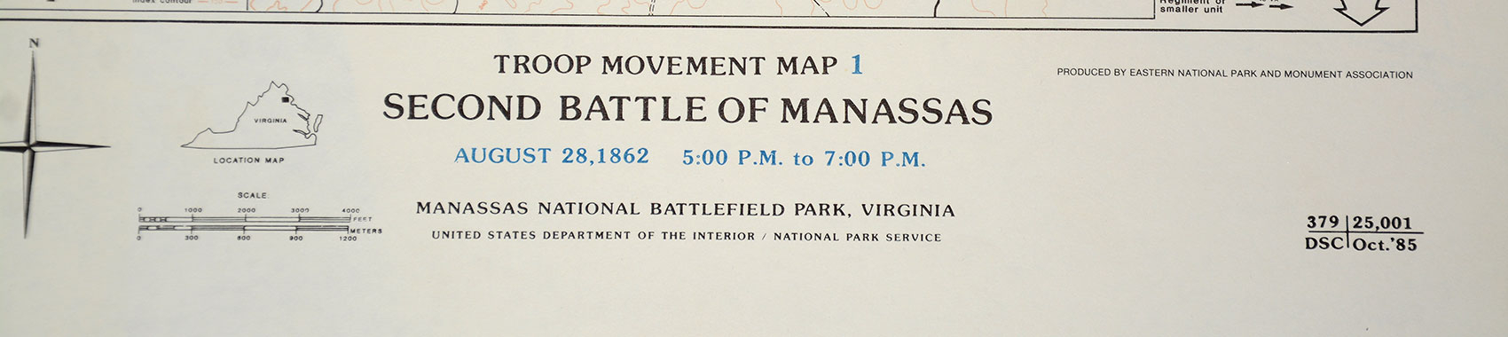
This is John Hennessy's “Second Manassas Battlefield Map Study”. This study, commissioned by the National Park Service and published by H.E. Howard as a volume of “The Virginia Civil War Battles and Leaders Series” includes 16 large maps. Each map depicts a given moment in time and goes down to the regimental level where data was available. Hennessy used primary sources, including the Official Records, to try to pinpoint everyone's position at various points in the battle. Printed in color. Maps are 15” x 22”.
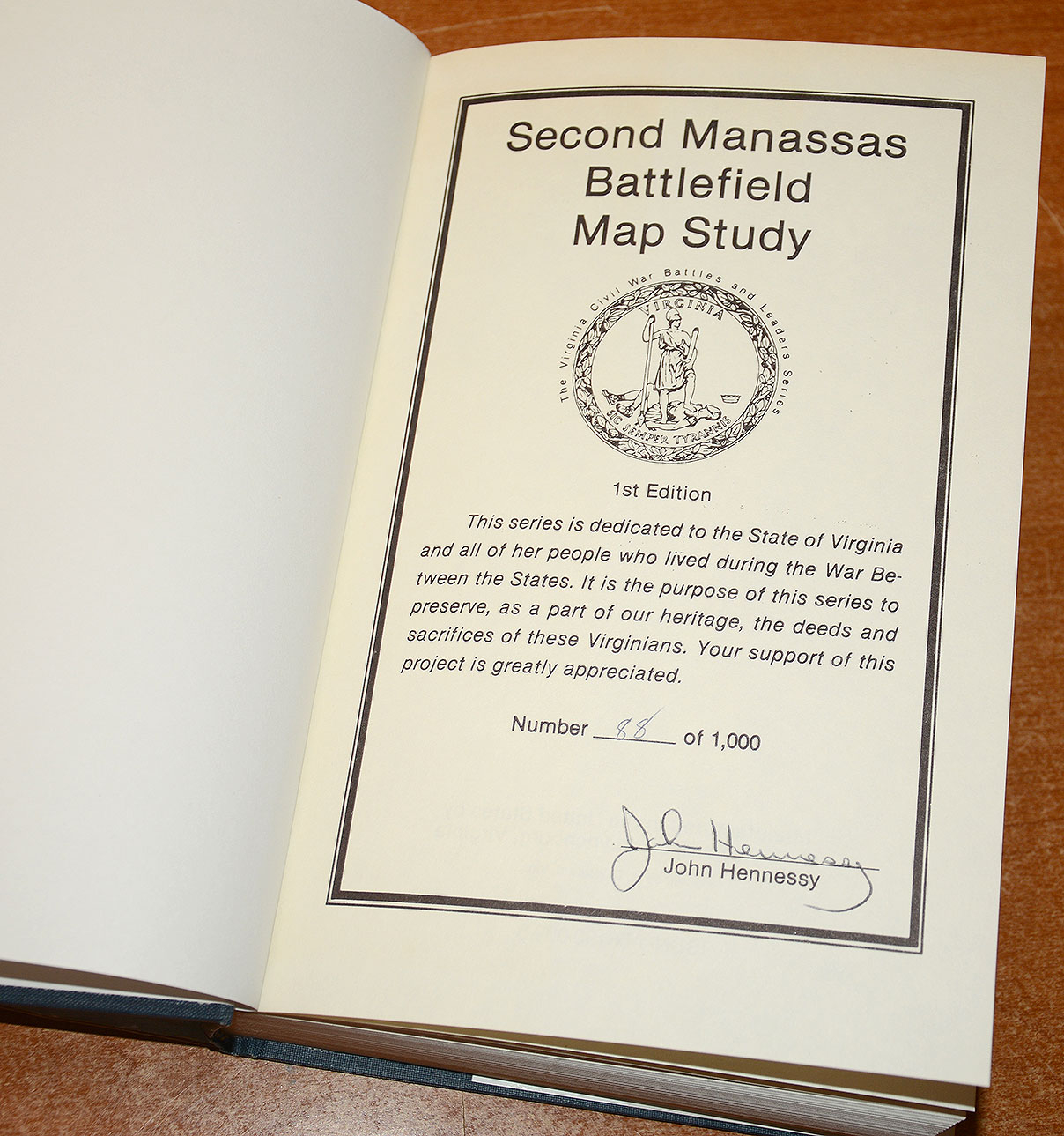
Book is hard cover with dust jacket. 6” x 9”, 504 pages, 1991. Number 88 of 1000 copies and signed by the author. Book and maps are in excellent condition. [jet] [PH:L]
Additional shipping charger required.
~~~~~~~~~~~~~~~~~~~~~~~~~~~~~~~~~~~
THIS ITEM, AS WITH ALL OTHER ITEMS AVAILABLE ON OUR WEB SITE,
MAY BE PURCHASED THROUGH OUR LAYAWAY PROGRAM.
CLICK HERE FOR OUR POLICIES AND TERMS.
THANK YOU!
Inquire About BOOK & MAPS – VIRGINIA CIVIL WAR BATTLES AND LEADERS SERIES – “SECOND MANASSAS BATTLEFIELD MAP STUDY”
Most Popular
Historical Firearms Stolen From The National Civil War Museum In Harrisburg, Pa »
Theft From Gravesite Of Gen. John Reynolds »
Selection Of Unframed Prints By Don Troiani »
Fine Condition Brass Infantry Bugle Insignia »
Large English Bowie Knife With Sheath 1870’S – 1880’S »
Imported (Clauberg) Us Model 1860 Light Cavalry Officer's Saber »
featured item
1847 CONGRESSIONAL RESOLUTIONS OF THANKS TO GEN. ZACHARY TAYLOR AND HIS OFFICERS AND MEN FOR MONTERREY, PERSONALLY DISPATCHED BY PRESIDENT POLK
Zachary Taylor received the formal thanks of Congress three times, along with gold medals, for victories in the Mexican War, the largest number of such resolutions and awards made by Congress to anyone. This is an official State Department copy on… (766-938). Learn More »