


site search
online catalog
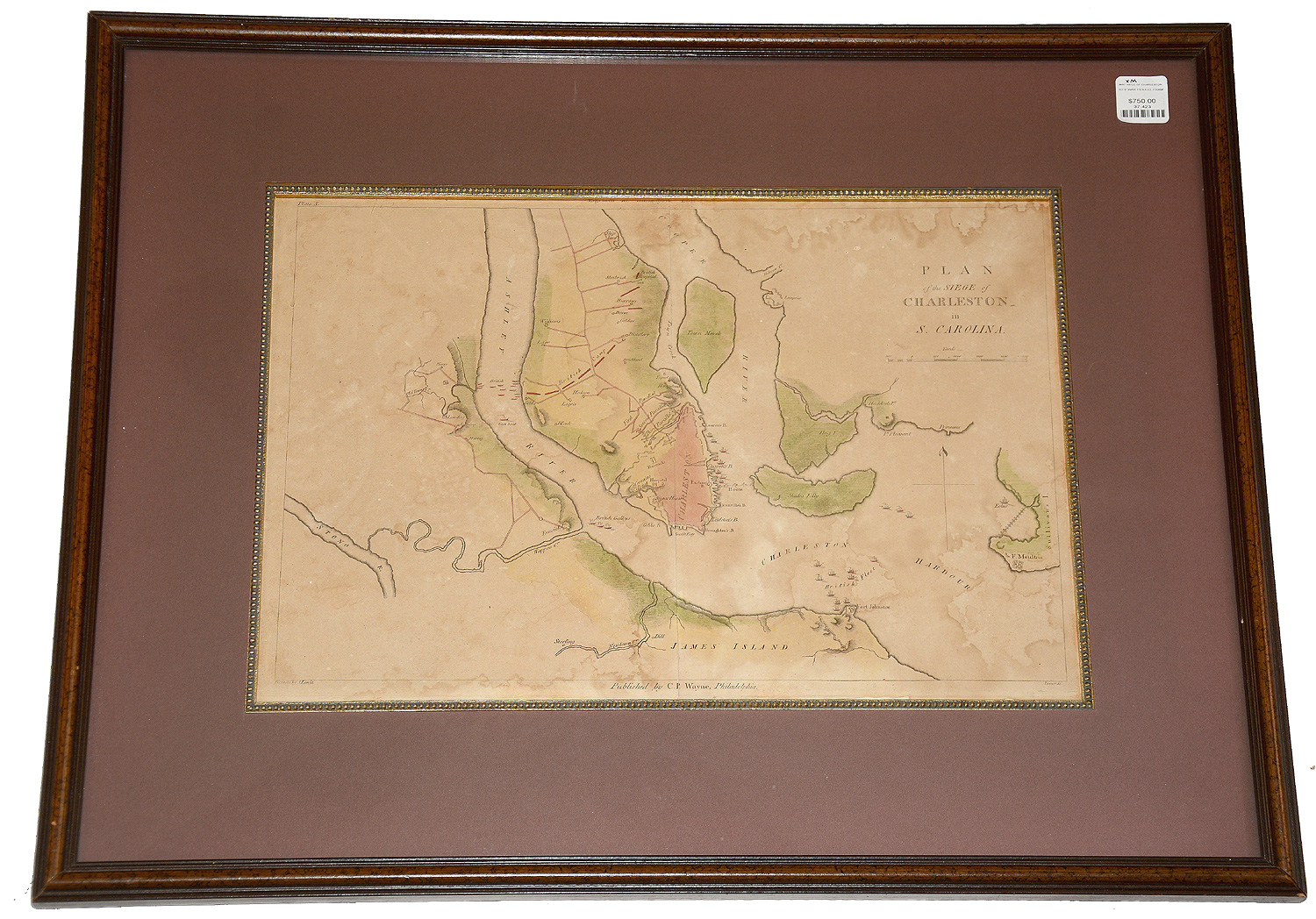
HAND COLORED MAP: “PLAN OF THE SIEGE OF CHARLESTON IN S. CAROLINA” IN THE REVOLUTIONARY WAR FROM JOHN MARSHALL’S 1807 LIFE OF WASHINGTON
$750.00 SOLD
Quantity Available: None
Item Code: 37-423
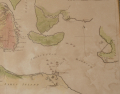


Published from 1804 to 1807, Marshall’s Life of Washington is valued as a contemporary account by one who knew and served under Washington. Best known as Chief Justice of the Supreme Court from 1801 to 1835, Marshall (1755-1835) published his biography through C.P. Wayne of Philadelphia in five text volumes with a sixth as atlas, from which this comes. A scale is included below the title at upper right. The bottom edge includes credits: “Drawn by S. Lewis” at left, who is Samuel Lewis (1753/54 – 1822,) and “Tanner &c” at right, which is likely engraver and map publisher Benjamin Tanner. At bottom center is, “Published by C.P. Wayne Philadelphia.”
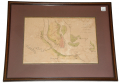
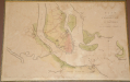
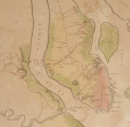
The map shows Charleston and its environs, including both the Ashley and Cooper Rivers flowing down from the top and James and Sullivan’s Islands at the bottom. Various residences and landmarks are noted, along with the position of Fort Moultrie at bottom right and various British blockading ships and galleys, but the main interest is the line of American defenses across the peninsula and the demarcation of both the British camps their progressive approach to the city in the erection of their first, second, and third “parallels” or siege-works.
The siege was part of the new British “southern strategy” implemented in 1779 and intended to take advantage of supposed loyalist sympathies in the southern colonies. They made a promising start and one of the worst American defeats, in a war full of American defeats, was the surrender of Charleston and its garrison in May 1780 after a siege of six weeks. The British victory eliminated the largest American effective field force in the south and took in more than 5,000 prisoners, 300 artillery pieces, 5,000 muskets, tens of thousands of artillery and musket rounds, regimental flags, as well as various ships, boats, and supplies. It was a disaster that still stung Washington even at Yorktown, when he limited the British to the “honors of war” they had accorded the Americans at Charleston and directed Cornwallis’s second in command to deliver his sword to General Lincoln, who had commanded the garrison.
This has been nicely framed and measures about 22 by 17 ¼ inches overall, with a gilt beaded inner edge to the frame and the maroon mat which has opening about 14 7/8 by 10 inches. There are some thin water stains and foxing as shown, and one vertical fold slightly affecting the “P.” of the publisher’s name, but the map displays very nicely and is ready to hang. [sr] [ph:L]
~~~~~~~~~~~~~~~~~~~~~~~~~~~~~~~~~~~
THIS ITEM, AS WITH ALL OTHER ITEMS AVAILABLE ON OUR WEB SITE,
MAY BE PURCHASED THROUGH OUR LAYAWAY PROGRAM.
CLICK HERE FOR OUR POLICIES AND TERMS.
THANK YOU!
Inquire About HAND COLORED MAP: “PLAN OF THE SIEGE OF CHARLESTON IN S. CAROLINA” IN THE REVOLUTIONARY WAR FROM JOHN MARSHALL’S 1807 LIFE OF WASHINGTON
For inquiries, please email us at [email protected]
Most Popular
Historical Firearms Stolen From The National Civil War Museum In Harrisburg, Pa »
Theft From Gravesite Of Gen. John Reynolds »
Selection Of Unframed Prints By Don Troiani »
Fine Condition Brass Infantry Bugle Insignia »
British Imported, Confederate Used Bayonet »
Scarce New Model 1865 Sharps Still In Percussion Near Factory New »
featured item
THE NORFOLK LIGHT ARTILLERY BLUES! IMPRESSIVE HALF PLATE DAGUERREOTYPE BY WHITEHURST IN A WONDERFUL WHITEHURST CASE
This image is not only mounted with a Whitehurst marked mat, but has a full thermoplastic figural case with a purple velvet facing pad embossed with a large eagle flourishing a ribbon reading “J.H. Whitehurst” and holding a shield or plaque with… (1138-1799). Learn More »
site search
Upcoming Events
May 16 - 18: N-SSA Spring Nationals, Fort Shenandoah, Winchester, VA Learn More »