


site search
online catalog
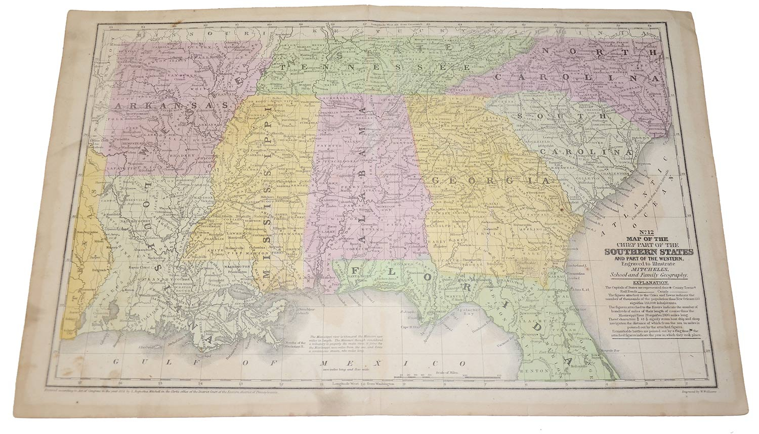
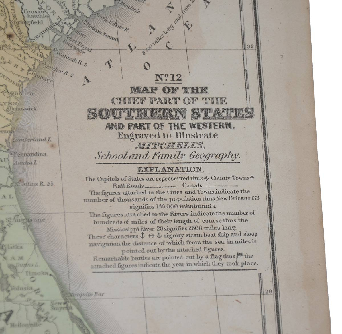
MITCHELLES MAP, NO. 12 – “MAP OF THE CHIEF PART OF THE SOUTHERN UNITED STATES AND PART OF THE WESTERN”
Hover to zoom
$50.00 SOLD
Originally $95.00
Quantity Available: None
Item Code: 998-1209
Engraved to illustrate Mitchelles School and Family Geography, by W. Williams. Published by S. Augustus Mitchell, 1852. 17.75 x 11.5”. Attractive colored map of southern states: North Carolina, South Carolina, Georgia, north Florida, Tennessee, Alabama, Mississippi, Arkansas & Louisiana, bounded on the east by the Atlantic Ocean, and on the south by the Gulf of Mexico. Superb antique, suitable for framing. [jp][ph:L]
~~~~~~~~~~~~~~~~~~~~~~~~~~~~~~~~~~~
THIS ITEM, AS WITH ALL OTHER ITEMS AVAILABLE ON OUR WEB SITE,
MAY BE PURCHASED THROUGH OUR LAYAWAY PROGRAM.
CLICK HERE FOR OUR POLICIES AND TERMS.
THANK YOU!
Inquire About MITCHELLES MAP, NO. 12 – “MAP OF THE CHIEF PART OF THE SOUTHERN UNITED STATES AND PART OF THE WESTERN”
Most Popular
Historical Firearms Stolen From The National Civil War Museum In Harrisburg, Pa »
Theft From Gravesite Of Gen. John Reynolds »
Selection Of Unframed Prints By Don Troiani »
Fine Condition Brass Infantry Bugle Insignia »
Rare Identified 65Th Ny Sergeant’s Jacket, With Manscript Material: 1St U.s. Chasseurs »
featured item
CONFEDERATE CLIP POINT BOWIE WITH SALVAGED MUSICIAN SWORD BRASS HILT
This clip-point Bowie a great example of southern improvisation- a kind of weapons-making version of folk art – not sophisticated, but with an appeal of it own. Measuring 19.5 inches overall, the knife has a 13.25 inch blade that is 1.5 inches… (490-3265). Learn More »