


site search
online catalog
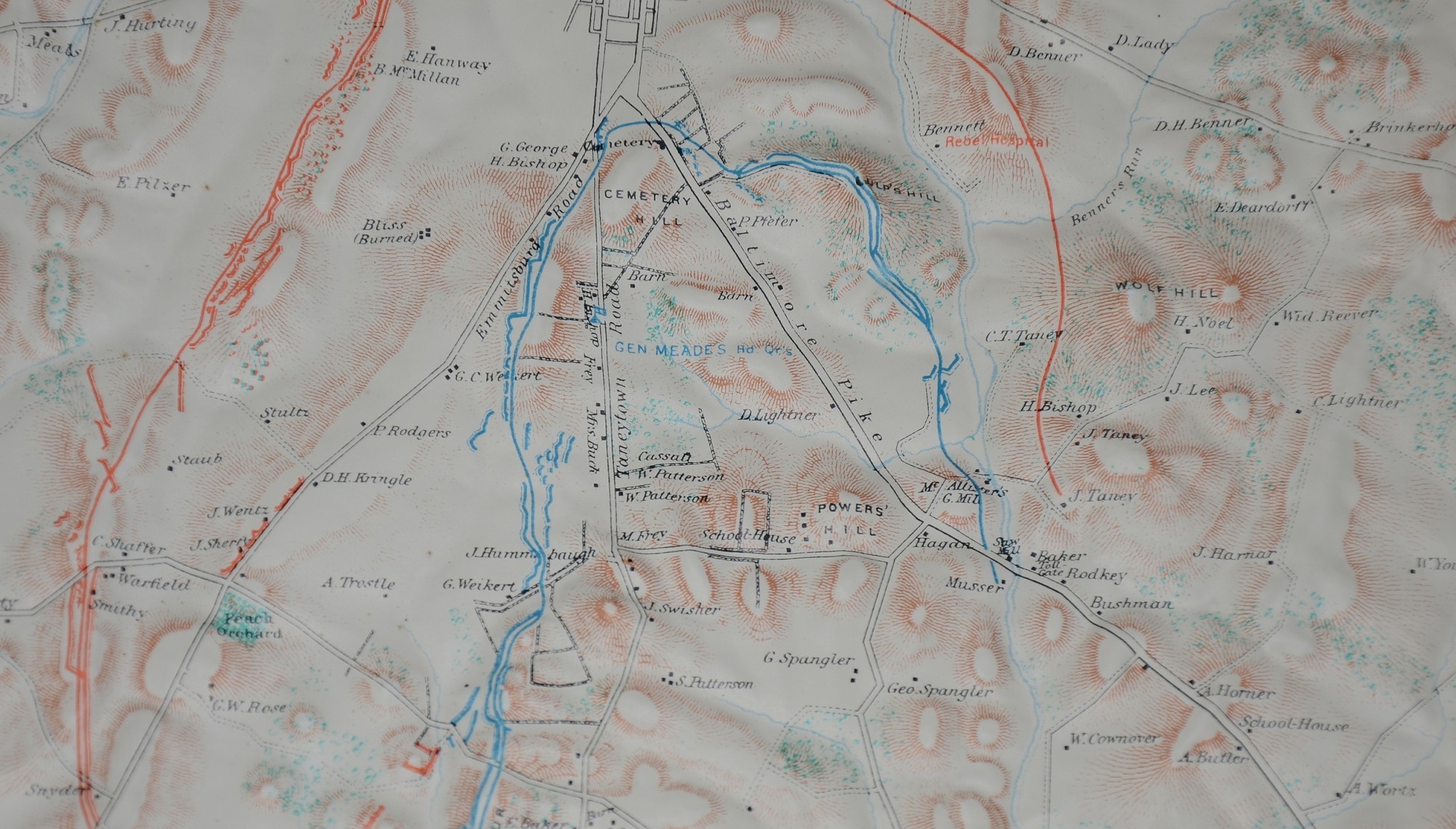
1960 RELIEF MAP OF GETTYSBURG
Hover to zoom

$95.00 SOLD
Quantity Available: None
Item Code: 635-233
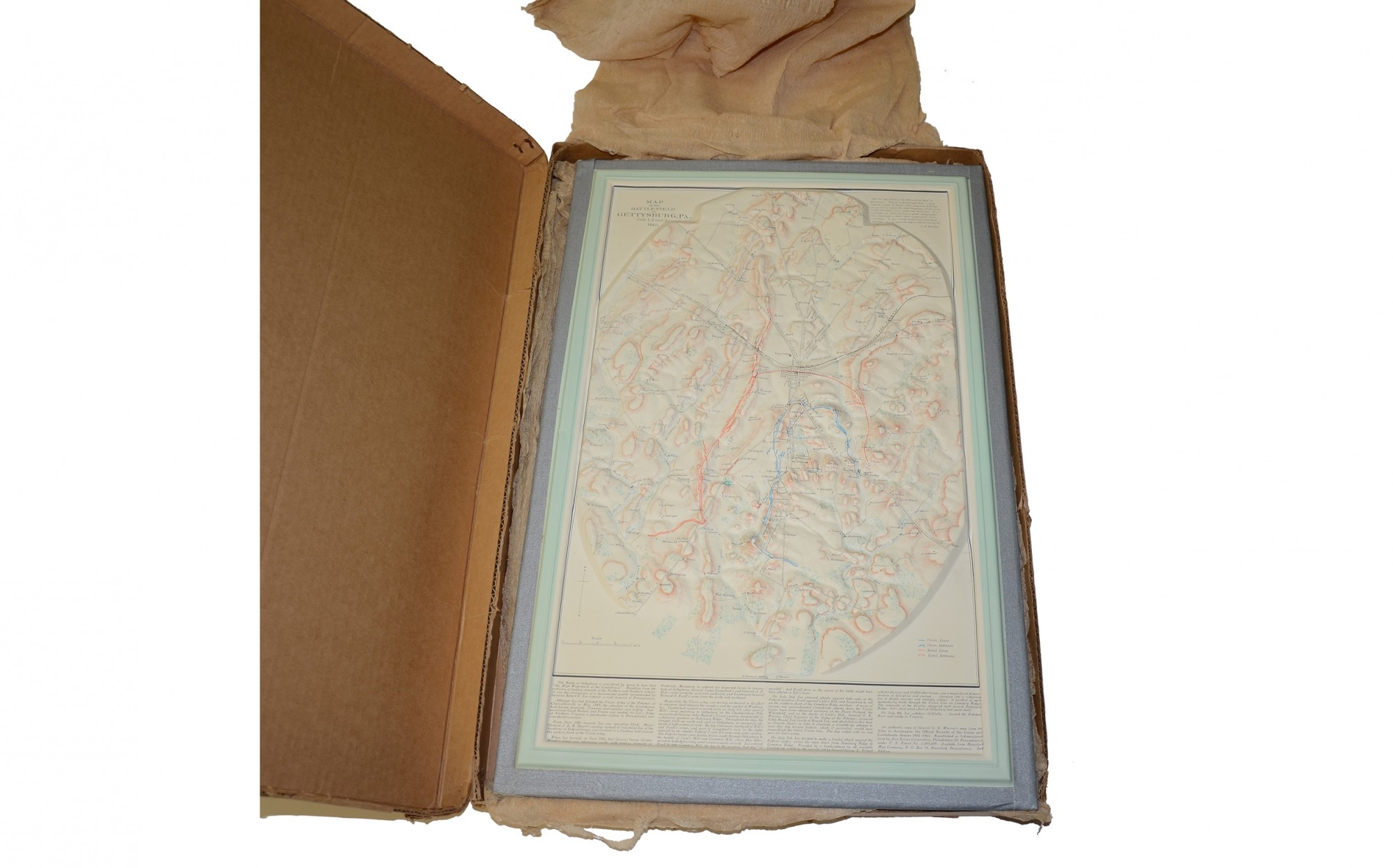
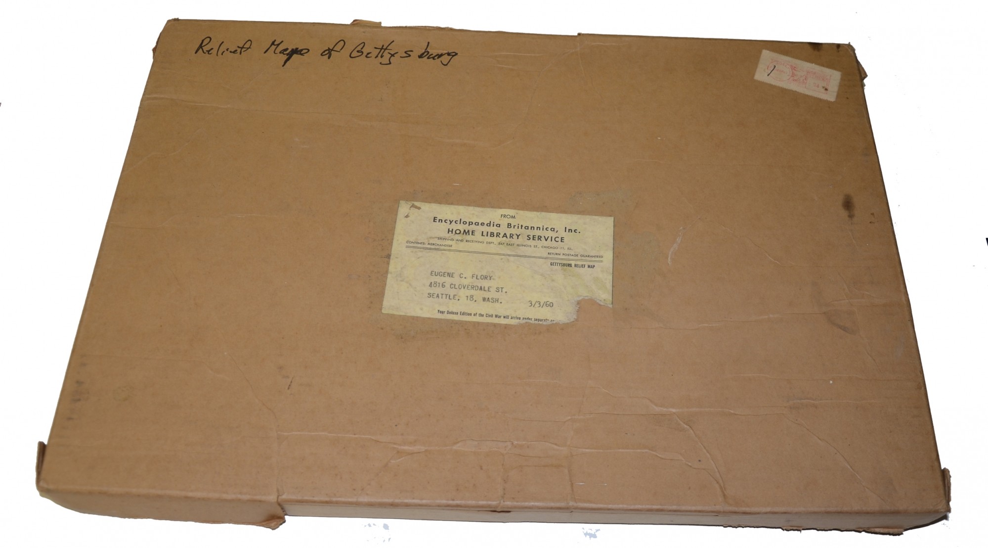
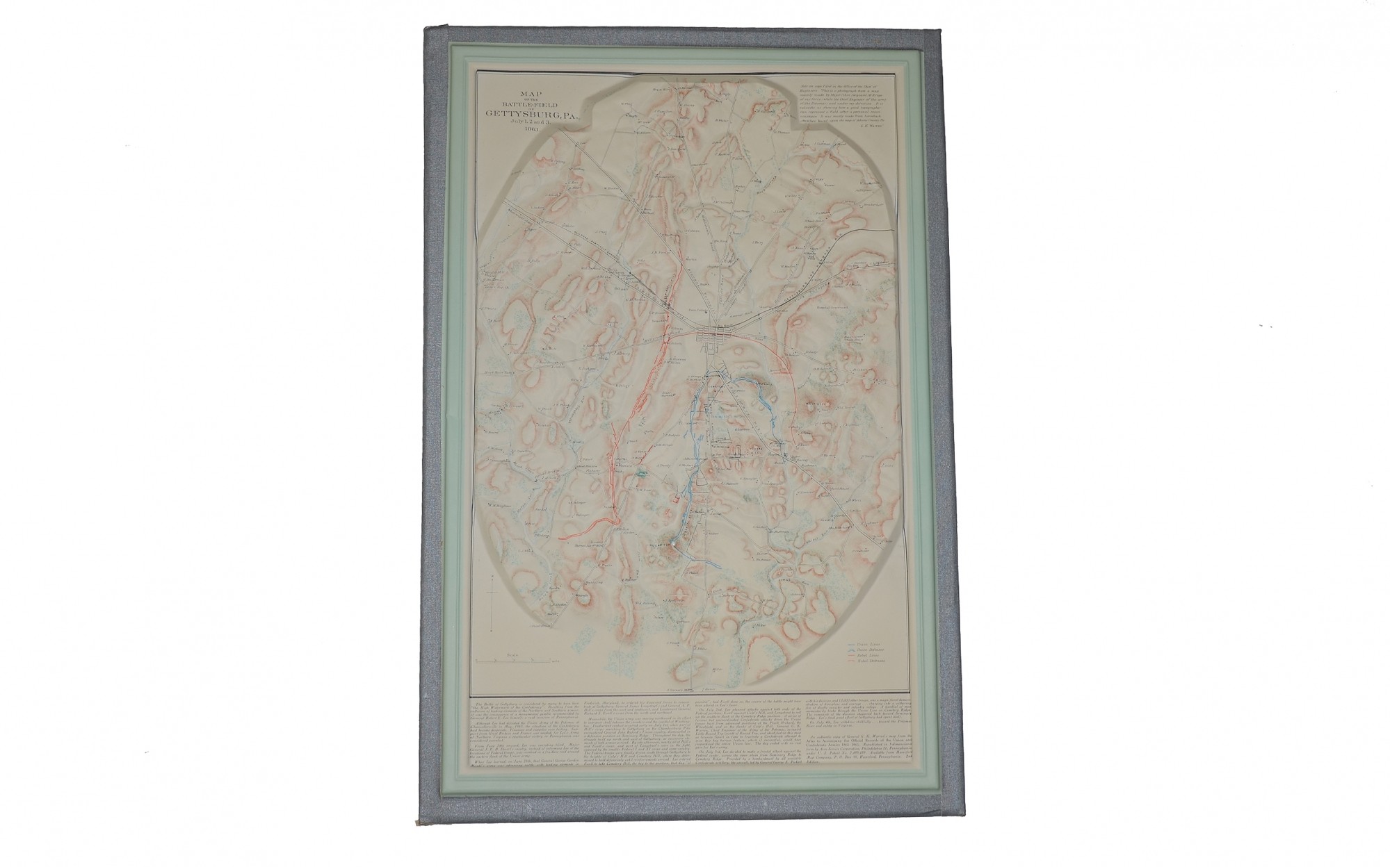
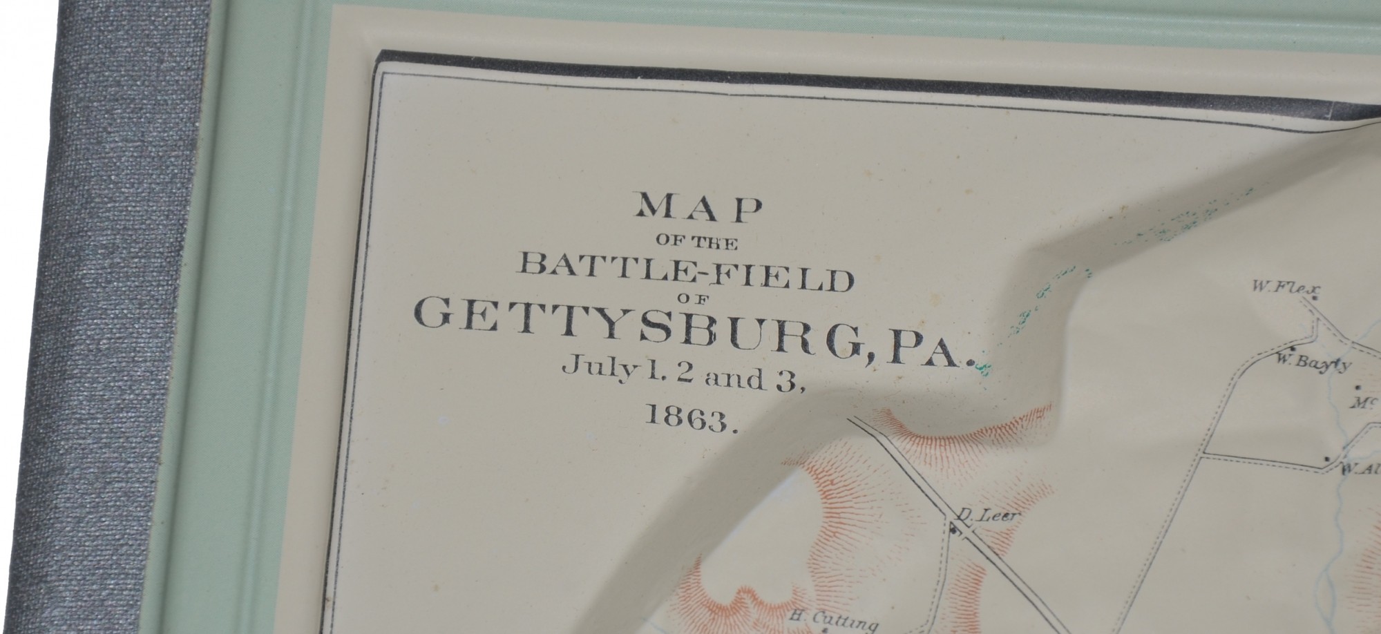
This is a very interesting map of the Gettysburg area. Made of plastic and moulded in relief to show the terrain. Union and Confederate positions are shown in blue and red. All features illustrated including homes, wooded areas, hills, mountains, and roads. Measures 13 ½” x 20 ½”. No wear. Most interesting, this comes packed in its original mailing box. Post marked 3/14/1960 with shipping label from the Encyclopedia Britannica, Home Library Service. Rare centennial celebration era map of Gettysburg. [jet]
~~~~~~~~~~~~~~~~~~~~~~~~~~~~~~~~~~~
THIS ITEM, AS WITH ALL OTHER ITEMS AVAILABLE ON OUR WEB SITE,
MAY BE PURCHASED THROUGH OUR LAYAWAY PROGRAM.
FOR OUR POLICIES AND TERMS,
CLICK ON ‘CONTACT US’ AT THE TOP OF ANY PAGE ON THE SITE,
THEN ON ‘LAYAWAY POLICY’.
Inquire About 1960 RELIEF MAP OF GETTYSBURG
Most Popular
Historical Firearms Stolen From The National Civil War Museum In Harrisburg, Pa »
Theft From Gravesite Of Gen. John Reynolds »
Selection Of Unframed Prints By Don Troiani »
Fine Condition Brass Infantry Bugle Insignia »
Large English Bowie Knife With Sheath 1870’S – 1880’S »
Imported (Clauberg) Us Model 1860 Light Cavalry Officer's Saber »
featured item
NEAR EXCELLENT CONDITION COLT M1851 NAVY
A near excellent Middle Fourth Model Colt M1851 Navy, with all-matching serial number 141159, to which the Colt site assigns an 1863 production date. This model falls in the #118000-#16800 range, overlapping with earlier and particularly later… (302-123). Learn More »
site search
Upcoming Events
The shop is currently closed so that we may conduct our annual inventory. We are available by phone… Learn More »