


site search
online catalog
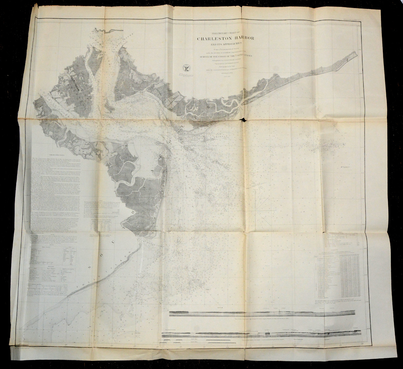
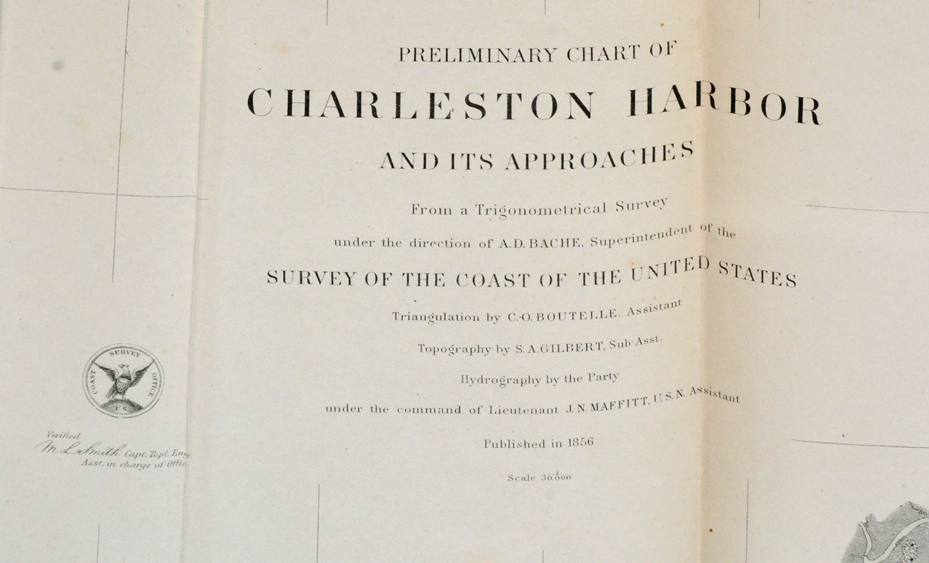
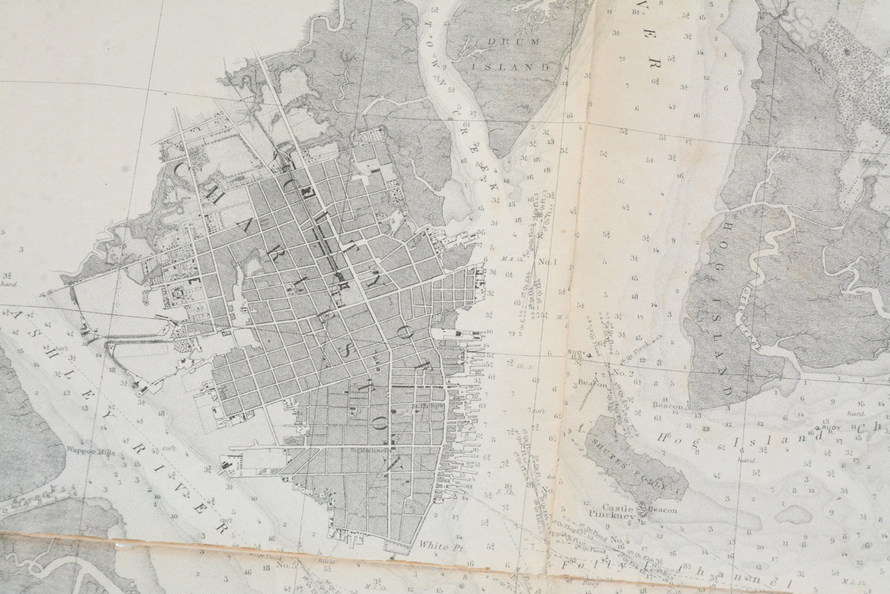
PRELIMINARY CHART OF CHARLESTON HARBOR AND ITS APPROACHES
Hover to zoom
$95.00 SOLD
Quantity Available: None
Item Code: 2021-69
A. D. BACHE, SUPERINTENDENT OF THE SURVEY OF THE COAST OF THE UNITED STATES. Dated 1856. Topographical map, 34 x 32”. Exhibits fold-marks and cracks along fold-lines. Else VG and highly attractive and frameable (with care). In protective sleeve. [jp [ph:L]
~~~~~~~~~~~~~~~~~~~~~~~~~~~~~~~~~~~
THIS ITEM, AS WITH ALL OTHER ITEMS AVAILABLE ON OUR WEB SITE,
MAY BE PURCHASED THROUGH OUR LAYAWAY PROGRAM.
CLICK HERE FOR OUR POLICIES AND TERMS.
THANK YOU!
Inquire About PRELIMINARY CHART OF CHARLESTON HARBOR AND ITS APPROACHES
Most Popular
Historical Firearms Stolen From The National Civil War Museum In Harrisburg, Pa »
Theft From Gravesite Of Gen. John Reynolds »
Selection Of Unframed Prints By Don Troiani »
Fine Condition Brass Infantry Bugle Insignia »
featured item
IDENTIFIED ISSUE RED BLANKET OF THEODORE P. BOWKER 13th MASSACHUSETTS - DIED OF WOUNDS AT ANTIETAM!
This is a rare, early-war, identified Massachusetts issue red blanket carried by a soldier in the 13th Massachusetts who was wounded at Antietam on Sept. 17, 1862, and died of those wounds at a U.S. hospital at Rappahannock Station on November 12.… (490-7138). Learn More »